

Photo: Dalgial
White Pine Cone — State Flower
Maine
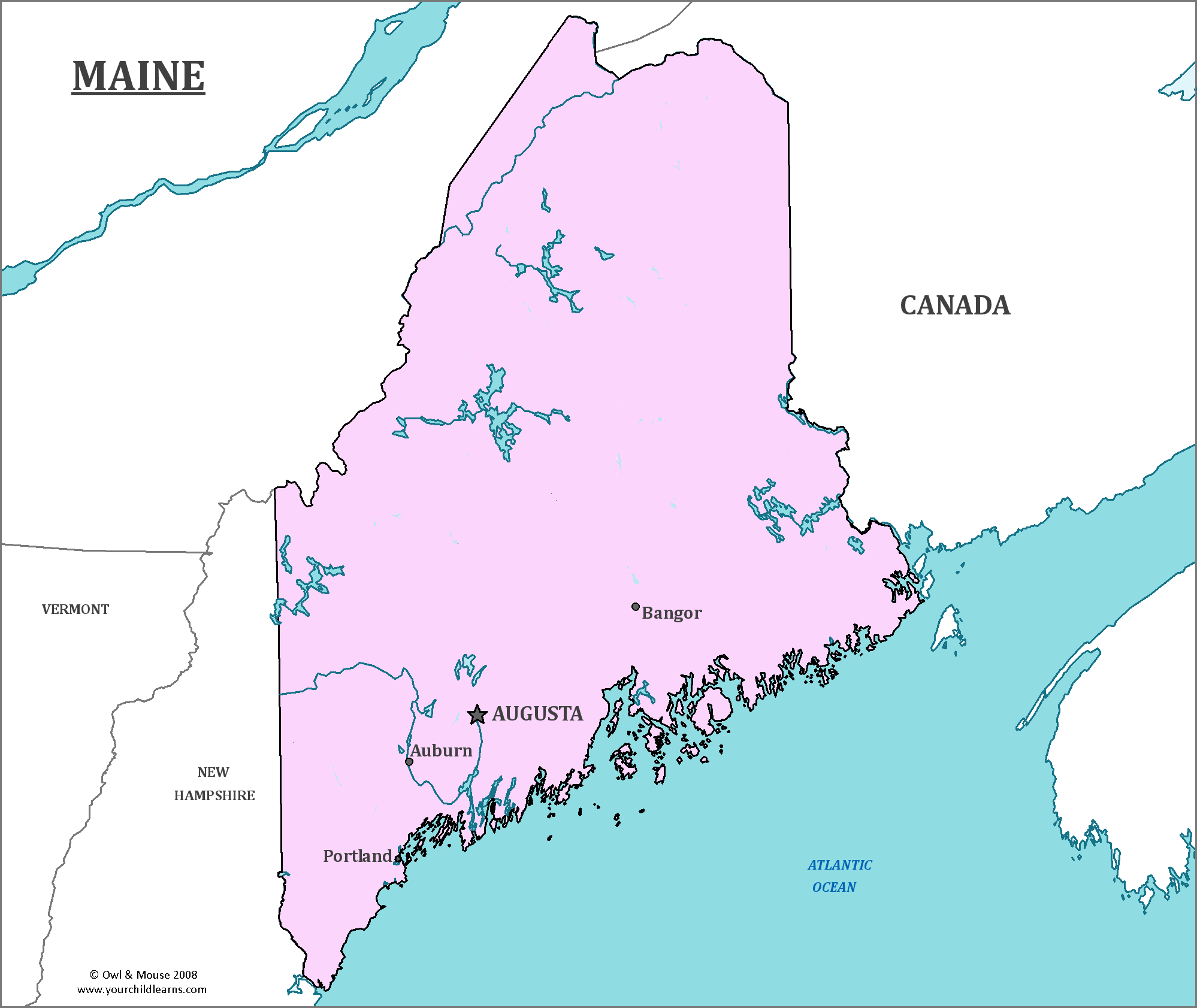
Maine is the northeastern most state of the United States, forming the northern tip of the New England Region. It contains West Quoddy Head, which is the Easternmost point of land in the contiguous US. Maine faces the Atlantic Ocean to its east, New Hampshire to the southwest, and the rest is surrounded by Canada.
Date first visited by Europeans: The first recorded European to explore Maine was Estêvão Gomes, an explorer in service of the Spanish Empire, in 1525.
Date admitted to US: 1820
Capital: Augusta
Largest City: Portland
Terrain: Maine is known for being home to low, rolling mountains and having a rocky, jagged coastline with many small islands. Maine is home to many forests, and over 80% of the state is still covered by forests.
The coastline of Maine is often described as a ‘drowned coast’, because many of the features were recently (in geological time) above water but a rising sea level has caused former hills to create islands.
Area: 35,385 square miles
Area Rank: 39th
Population: 1,350,089
Population rank: 41st
Electoral Votes: 4
Two islands within the borders of Maine, Machias Seal Island and North Rock, are both claimed by both the United States and Canada. The Canadian Coast Guard maintains a lighthouse on Machias Seal Island despite the claim by the United States.
Maine is also close to the Old Sow Whirlpool, named for the pig-like noises it supposedly makes. It is the largest Whirlpool in the Western Hemisphere, and is located near Moose Island.
The official state cat of Maine is the appropriately named Maine Coon cat. Through the ancestors of these cats were introduced to Maine, the breed developed there. The Maine Coon is known for being large, having a thick coat, and making distinctive trilling sounds.
Maine has the highest proportion of French Americans of any state, and they make up nearly one quarter of the population of the state.
In 1820, Maine voted to separate from Massachusetts due to conflicting interests and geographical separation. Tensions between the two were worsened by the war of 1812, when wealthy people who supported the British refused to defend what would become Maine. It became a separate state as a part of the Missouri Compromise, as Northerners were worried about the power and number of slave-holding states.
Print this map of the United States US States and Capitals Map Quiz
Free Maps, Map Puzzles and Educational Software: Owl and Mouse Educational Software


