
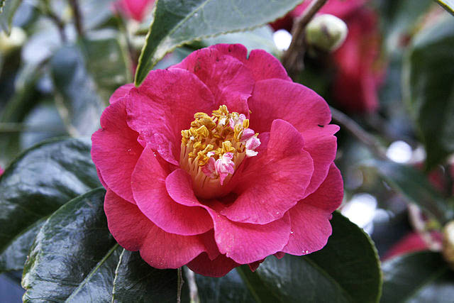
Camellia — Alabama State Flower
Alabama
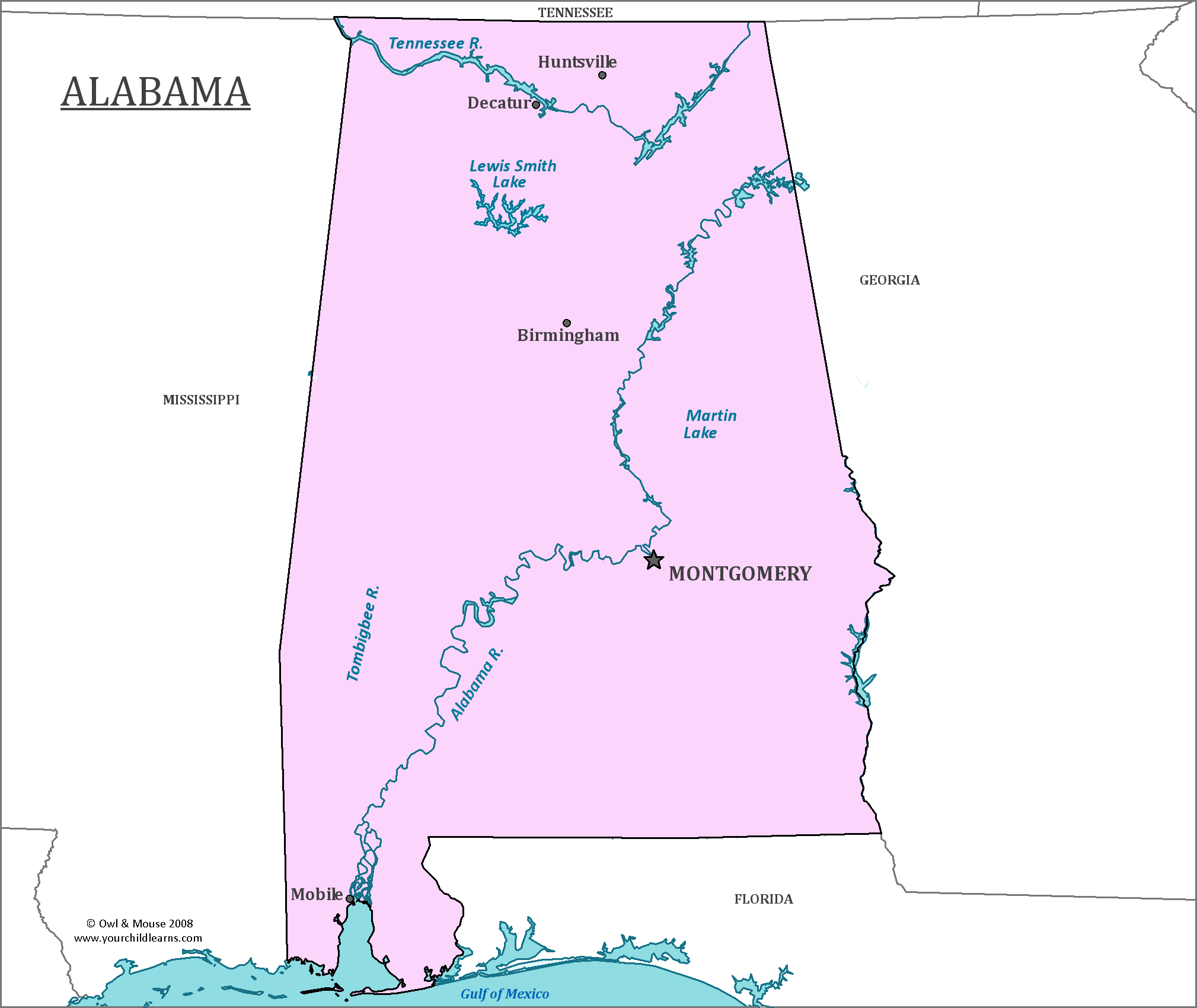
Alabama is in the south-eastern part of the United States, bordering on the Gulf of Mexico. It has the second largest inland waterway system in the US.
Date first discovered by Europeans: The first Europeans to discover Alabama were a Spanish expedition led by Hernando De Soto in 1540.
Date admitted to US: 1819
Date seceded from the US: 1861
Date readmitted to US: 1868
Capital: Montgomery
Largest City: Birmingham
Terrain: The southern end of the Appalachian Mountains are in the north, but give way to a coastal plain in the southern part of the state.
Area: 52,419
Area rank: 30th
Population: 4,858,079
Population rank:24th
Electoral votes: 9
Although members of Hernando De Soto’s expedition were the first Europeans to discover Alabama, it was not settled by Europeans until 1702 when the French built Old Mobile. That is 160 years after its initial discovery by Europeans. Mobile was later moved to its current site in 1711 because of flooding.
Quill's Quiz - 1100 Question US Mega Geography Quiz
Print this map of the United States US States and Capitals Map Quiz
Free Maps, Map Puzzles and Educational Software: Owl and Mouse Educational Software
Print this map of the United States US States and Capitals Map Quiz
Free Maps, Map Puzzles and Educational Software: Owl and Mouse Educational Software
Search Owl & Mouse:
