
Quill's Quiz - 1100 Question US Mega Geography Quiz
Print this map of South Korea US States and Capitals Map Quiz
Free Maps, Map Puzzles and Educational Software: Owl and Mouse Educational Software
Print this map of South Korea US States and Capitals Map Quiz
Free Maps, Map Puzzles and Educational Software: Owl and Mouse Educational Software
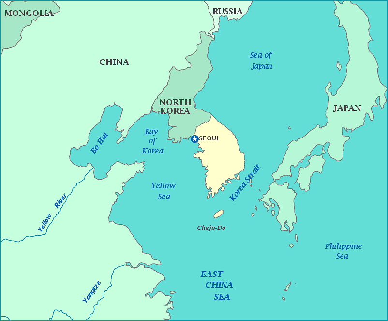
South Korea
South Korea is on the southern part—roughly one half of—the Korean peninsula, which juts off from the main body of Asia into the Pacific Ocean, plus islands off its southern tip. Its only land border is 238 km it shares with North Korea, which is the most heavily fortified border in the world. South Korea has water borders on three sides—the Yellow Sea to the west, the Korea strait, separating South Korea from Japan, on the southeast, and the Sea of Japan to the east and northeast.
From the 7th century until WWII, South Korea and North Korea were a single country. The Korean War (1950-1953—see M.A.S.H.) was fought between South Korea (w/ US and UN forces) and North Korea (with Chinese and Soviet Union support). An armistice—but not a peace treaty—was signed in 1953, creating a demilitarized zone at about the 38th parallel. South Korea has had rapid economic growth since the war, giving it a per capita (per person) income of about 14 times that of North Korea.
