
Quill's Quiz - 1100 Question US Mega Geography Quiz
Print this map of Paraguay US States and Capitals Map Quiz
Free Maps, Map Puzzles and Educational Software: Owl and Mouse Educational Software
Print this map of Paraguay US States and Capitals Map Quiz
Free Maps, Map Puzzles and Educational Software: Owl and Mouse Educational Software
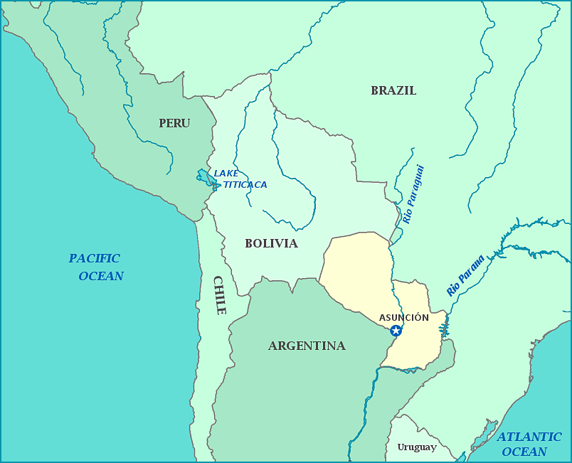
Paraguay
The Republic of Paraguay is sometimes called 'Corazon de America' or '(the) Heart of (South) America), due to it's location in the center of the continent. Before the arrival of Europeans, the area was inhabited by small, nomadic tribes. The area was swiftly explored and settled by the Spanish, who were eager to claim the area and its precious metals before the Portuguese could.
The country declared independence from Spain in 1811, with Jose Rodriguez de Francia asserting control in 1840. He cared little for other countries, both overseas and next door, soon eliminating contact with them and eventually cutting off contact for everyone else in the country. After De Francia's death in 1840, the country was ruled by various juntas until Carlos Antonio Lopez, De Francia's nephew, declared himself dictator. Despite his title, he modernized the country in terms of rights and trade, as well as establishing a non-aggression pact with Argentina, peacefully separating from it in 1842.
Lopez died in 1862, and power went to his son Francisco Solano Lopez, who ended the non-aggression pact and led the country into the most devastating war in its history two years later against Argentina, Brazil, and Uruguay. The war lasted from 1864 to 1870 and cost Paraguay an estimated 60% to 70% of its population on the battlefield and in hospitals, as well as 140,000 square miles of territory. The country has been recovering ever since.
Between 1904 and 1954 Paraguay had 31 presidents, most removed from office forcefully by the next. Politics eventually became stable and consistent enough to start the Chaco War and reclaim much of their lost territory, and later to enter WWII. Politics returned to instability, with worse tensions between political parties, giving Alfredo Stroessner an opportunity to install himself as dictator in 1954. While he was known for modernizing the country extensively, he was also known for abuses of power and human rights. He remained in power until 1989, leaving the country full of violence and political in-fighting that wasn't ended until the Paraguayan Civil War in 1997, which finally resulted in democracy being restored.
Geographically, the country is divided by the Rio Paraguay into Paraguay Oriental, the east; and Paraguay Occidental, the west. Paraguay Oriental is mostly plains and wooded hills, while Paraguay Occidental is mostly marshy plains. The climate of both sides ranges from tropical to subtropical. The average literacy rate is 71%, rather high for 30% to 50% of the population being poor and 19% living in poverty.
