
Print this map of India US States and Capitals Map Quiz
Free Maps, Map Puzzles and Educational Software: Owl and Mouse Educational Software
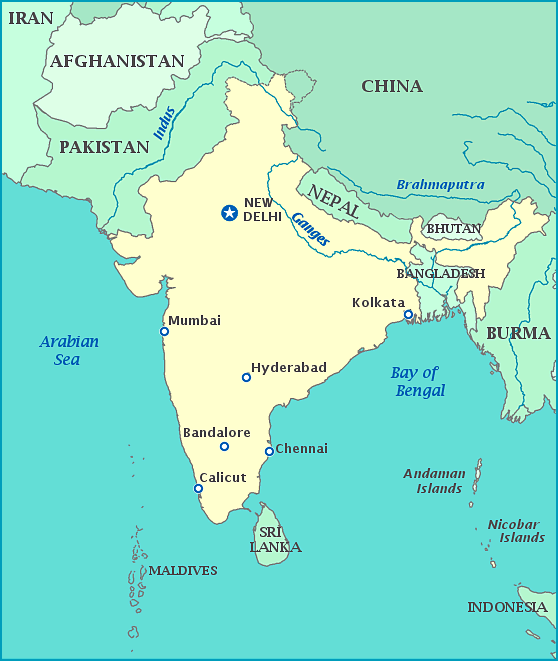
India is separated from much of the rest of Asia by the huge Himalayan mountains. The Himalayans were created by the Indian sub-continent bumping into the continent of Asia, raising the highest mountains in the world in the process. India is bordered by Pakistan to the northeast, and China, Nepal, and Bhutan to the north and northwest; and Burma to the east. India surrounds Bangladesh, which was once part of India, on three sides. The southern part of India is in the Indian Ocean; on the west coast of India is the Arabian Sea, on the east are the Bay of Bengal. Just off the southern tip of India is the island country of Sri Lanka, once called Ceylon.
