
Quill's Quiz - 1100 Question US Mega Geography Quiz
Print this map of Guinea Bissau US States and Capitals Map Quiz
Free Maps, Map Puzzles and Educational Software: Owl and Mouse Educational Software
Print this map of Guinea Bissau US States and Capitals Map Quiz
Free Maps, Map Puzzles and Educational Software: Owl and Mouse Educational Software
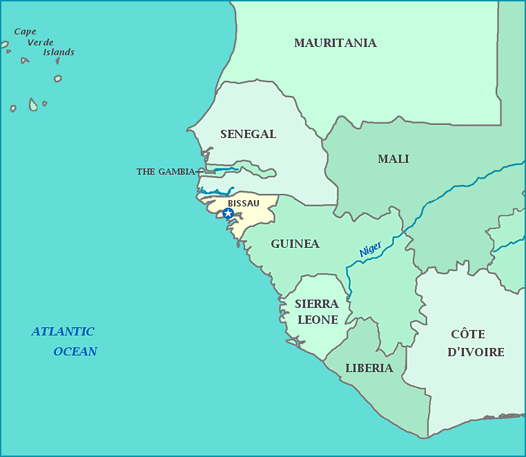
Guinea-Bissau
Guinea-Bissau is a small country on the coast of West Africa, facing the Atlantic Ocean, sandwiched between Senegal to the north and Guinea to the south. It was once part of the kingdom of Gabu, as well as part of the kingdom of Mali. It has a low-lying coast, with many indentations where streams and rivers meet the ocean. Inland, it is mostly savannah. It has many lovely off-shore islands, the Arquipélago dos Bijagós. Portuguese Guinea became known as the Slave Coast, where much of the slave trade left Africa for the Western hemisphere. As opposed to Guinea to its south, where French is a major language, most people in Guinea-Bissau speak Portuguese or Crioulo, which is a creole based on Portuguese.
Independence was declared in 1973, from Portugal. No elected president has yet served out his full term.
Guinea-Bissau has one of the lowest GDP per capita in the world. Bauxite is a major export.
Capital: Bissau
Area: 13,948 sq. mi
Population: 1,693,398
