
Print this map of Asia US States and Capitals Map Quiz
Free Maps, Map Puzzles and Educational Software: Owl and Mouse Educational Software
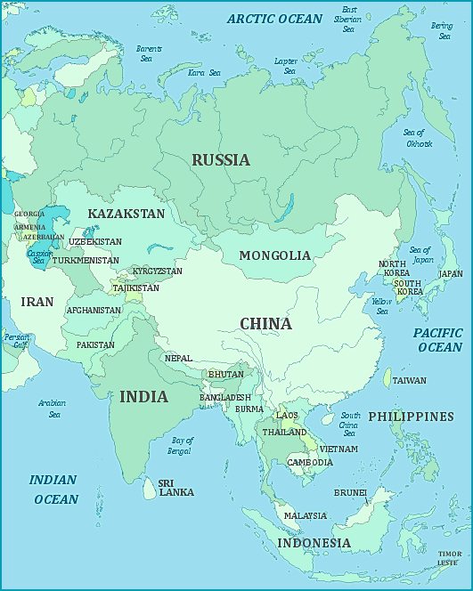
Asia is the largest continent, both in land area and in population. Asia and Europe share the Eurasian land mass; and the exact border is in some dispute. The Asia part of the Eurasia land mass stretches from the Ural mountains east to the Pacific ocean, and from far northern Siberia in the Arctic almost to the Equator, and the islands of South East Asia far below it. (The southern-most part of Asia is shown in the South-East Asia map). In its huge area, Asia contains Mt. Everest, the world’s highest mountain peak, in addition to about twenty other mountain peaks over 22,000 feet. When the subcontinent of India collided with the rest of the Asian land mass millions of years ago, it pushed the Asian tectonic plate up and created the highest mountains in the world. Asia has the greatest contrast in its geography—high mountains, desert, tropical jungles, cold plains, and fertile valleys. Both of the countries with the highest populations in the world—China and India—are in Asia. Again, two of the largest countries in terms of land mass are in Asia, China and Russia, and they share the world’s longest border.
