
Quill's Quiz - 1100 Question US Mega Geography Quiz
Print this map of Angola US States and Capitals Map Quiz
Free Maps, Map Puzzles and Educational Software: Owl and Mouse Educational Software
Print this map of Angola US States and Capitals Map Quiz
Free Maps, Map Puzzles and Educational Software: Owl and Mouse Educational Software
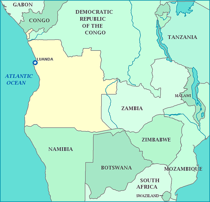
Map of Angola
Angola is in southern Africa, on the west coast. It is bordered by the Democratic Republic of the Congo, Namibia, and Zambia. The capital, Luanda, is Angola’s largest city. Angola's northwest province, Cabinda, is separated from the rest of the country by a strip of the Democratic Republic of the Congo.
What is now the Republic of Angola was ruled by the Portuguese for five centuries, with no truly defined border of where Portuguese rule stopped inland until the 1885 Berlin conference. Portugal laid claim to the land to monopolize slave trade in the region, later claiming more and more as explorers ventured inland, seeking natural resources to exploit instead. Angola began the fight for independence in 1975, which almost immediately became a flash point for world superpowers involved in the Cold War. While the fighting continued after independence until 2002, the people have not fared much better.
Angola has among the worst life expectancy and infant mortality in the world, despite rich mineral and oil resources.
Population: 18,565,269 [2013 est] Area:1,246,700 km2
