
Quill's Quiz - 1100 Question US Mega Geography Quiz
Print this map of Suriname US States and Capitals Map Quiz
Free Maps, Map Puzzles and Educational Software: Owl and Mouse Educational Software
Print this map of Suriname US States and Capitals Map Quiz
Free Maps, Map Puzzles and Educational Software: Owl and Mouse Educational Software
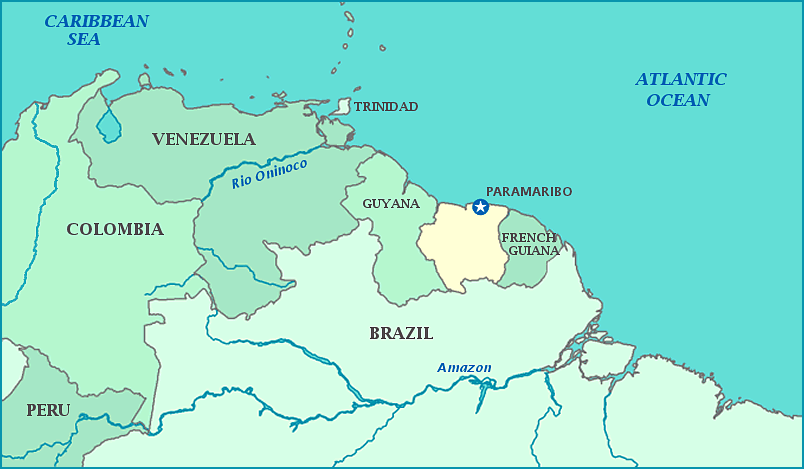
Suriname
The Republic of Suriname is geographically the smallest sovereign state in South America, yet culturally is part of the Caribbean. It is the only country in both American continents where Dutch is a major language.
The region was discovered in 1525 and explored by the Dutch, Spanish, and English. Both the English and Dutch settled the coast in the 17th century. Both settlements used their land for plantations of cocoa, coffee, sugarcane, and cotton; the English eventually traded theirs to the Dutch in exchange for the Dutch colony of New Amsterdam (now New York City). The plantations relied heavily on manual labor, forcing the Dutch to join the transatlantic slave trade and bring in thousands of African slaves to work the land.
Aided by jungle natives, many slaves ran away from their masters, eventually establishing their own tribes of mixed races and cultures. These jungle tribe members, who became known as Maroons to Europeans, constantly raided plantations in search of recruits, women, food, and weapons. Plantation owners often tried to hunt down the Maroons, but were outmatched in jungle survival and travel. In the 19th century treaties between Maroons and European landowners were made, giving sovereignty to tribes and establishing trade rights between the two. Slavery was abolished in 1853, but slaves were not released from bondage until after two years of job training. Despite the offer to return to plantation jobs for pay, most former slaves left plantations for the cities, creating a new need for laborers. This time, the Dutch turned to the Middle East and China for people to work their plantations. Treaties with the Maroons caused temporary problems at one point in 1941. Several tribes sold their land, containing bauxite mines, to the US company Alcoa, letting the country become occupied by the United states until trade agreements were sorted out between the two countries.
Independence was not quick for the tiny South American country, and the first few decades were rough. In 1954, the colony became an official country, governed by the Kingdom of the Netherlands. When negotiations for independence began nine years later, a third of the population left for the Netherlands, fearing economic and political problems. Even more left when those fears were proven true in 1975, when full independence was granted. Things worsened with a civil war in 1991 and a violent coup in 1998, well into 1999. In 2010, former dictator Desi Bouterse returned to power and remains in charge of the country to this day.
Bauxite remains a dominant export to this day. The country rests on the Guiana tectonic plate and over 80% of it is covered in rainforest thanks to two wet seasons and a tropical climate. Although small, the population is the most ethnically and culturally diverse population in the world.
