
Quill's Quiz - 1100 Question US Mega Geography Quiz
Print this map of Lesotho US States and Capitals Map Quiz
Free Maps, Map Puzzles and Educational Software: Owl and Mouse Educational Software
Print this map of Lesotho US States and Capitals Map Quiz
Free Maps, Map Puzzles and Educational Software: Owl and Mouse Educational Software
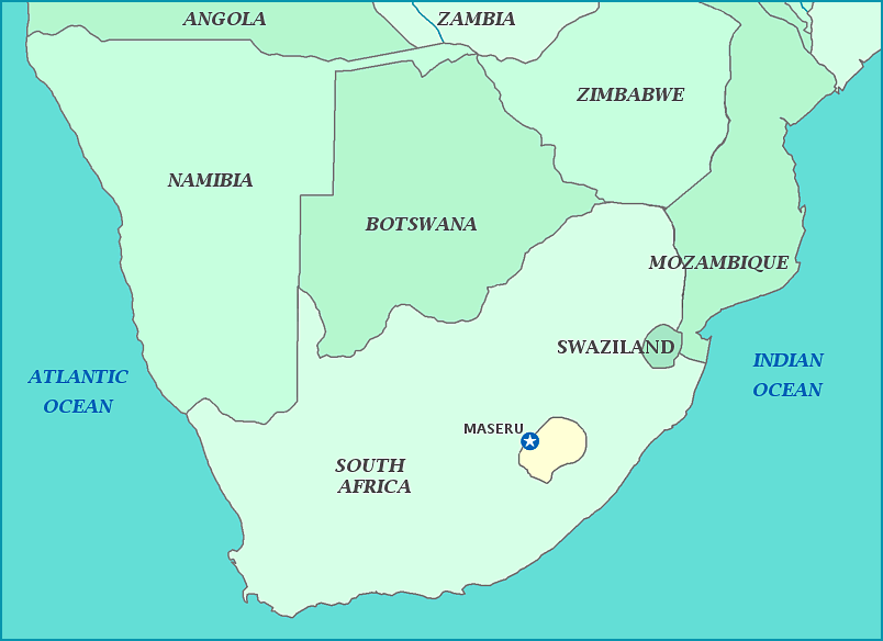
Lesotho
Lesotho, which is completely surrounded by the country of South Africa, is officially known as the Kingdom of Lesotho. It was known as Basutoland under the rule of King Moshoeshoe. British farmers tried to settle the land in 1838, but the King annexed their land ten years later. This led to a short war over the land in 1851 which the British lost badly. Despite this, Britain made the land a protectorate in 1868, when Moshoeshoe asked for defensive help. After the King's death, there was no one holding the natives back from violently expressing how oppressed they felt, which led to the Gun War in 1881. The country gained independence and changed its name in 1966. While approximately 40% of the population lives on $1.25 a day, the country boasts the highest literacy rate of all African countries at 85%. According to 2009 estimates, the HIV/AIDS prevalence is 23.6%, the highest in the world.
Total area is 30,353 sq km
Total land area is 30,355 sq km
Population is 1,936,181
