
Quill's Quiz - 1100 Question US Mega Geography Quiz
Print this map of Indonesia US States and Capitals Map Quiz
Free Maps, Map Puzzles and Educational Software: Owl and Mouse Educational Software
Print this map of Indonesia US States and Capitals Map Quiz
Free Maps, Map Puzzles and Educational Software: Owl and Mouse Educational Software
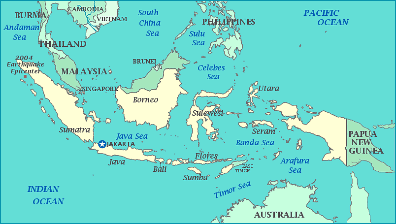
Officially named the Republic of Indonesia, these 17,508 islands are south of mainland Asia and north of Australia, between the Pacific Ocean and the Indian Ocean. They have been part of many important trade routes with China and India and much of the rest of coastal Asia since the 7th century. Human fossils and the remains of tools have been found among the islands, dating from between 35,000 to 1.5 million years ago. Hinduism and Mahayana Buddhism spread across the archipelago in 4th and 5th centuries with the Indian Pallava Dynasty, followed by Islam from traders in the 13th century. Regular contact with Europeans was established in 1512, mainly with the Dutch, who sought to push out the English who aspired to the same goal of dominating the lucrative spice trade, especially nutmeg, cloves, and pepper. In 1602 Dutch established Dutch East India company and soon became the dominant trading power, just as they had intended, only to go bankrupt in 1800. The Netherlands reestablished the Dutch East India Company in 1806, continuing Dutch control over the islands, though it was tenuous at best until the 20th century. The Dutch didn't hold a strong position for long, as Japan took the country in WWII, after which the archipelago declared independence.
While under Japanese control, over 4 million people were executed for resistance or suspected disloyalty. Dutch who remained encouraged resistance and independence while feigning to aid and support the Japanese army. Once the Japanese left in 1945, the Dutch immediately demanded rule over the new country. When Indonesia refused, the Dutch tried to retake the nation by force, with fighting ending in 1949, and the Dutch refusing to accept independence for New Guinea. Violence hadn't ended for the country, as an attempted coup in 1962 led to harsh anti-communist purges in which 500 people are estimated to have been killed. Although widely accused of corruption, the US gave its support when another coup, this time by the military, took over in 1968.
Only 6,000 of the islands are inhabited, scattered on either side of the equator. Indonesia shares islands with Brunei, Malaysia, and Papua New Guinea and includes Java, the most populous island in the world. It is the 15th largest country in land area and 7th in sea area; it is the 4th most populous country in the world. Although the largest ethnic group is Javanese, Indonesia defines itself proudly as a nation of many races; its proudly stated, 'Bhineka Tunggl Ika'--'Unity in Diversity' or 'Many, yet One'. It sits on the edges of the Pacific, Eurasian, and Australian tectonic plates, thus in the way of tsunamis, earthquakes, and volcanoes including super-volcanoes Krakatoa and Toba, both of which are famous for devastating eruptions, such as Toba's 70,000 years ago which caused a global ecological catastrophe. Indonesia sees a tropical climate with monsoon seasons. With 60% of the country covered in forests, it holds the second highest level of biodiversity in the world, after Brazil.
