
Print this map of El Salvador US States and Capitals Map Quiz
Free Maps, Map Puzzles and Educational Software: Owl and Mouse Educational Software
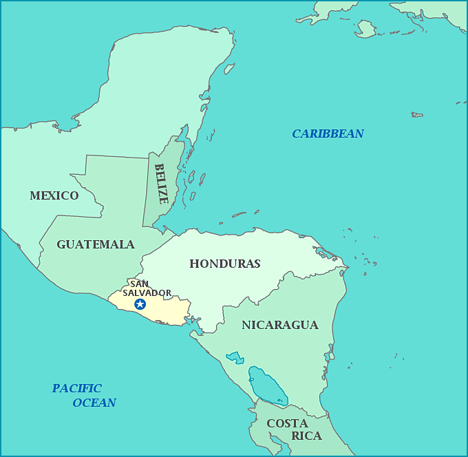
El Salvador
Officially the Republic of El Salvador, or Republica del Salvador in Spanish, El Salvador is the most densely populated country in Central America, yet has the third lowest birthrate. 86% of the populations is Mestizo, which means their racial heritage is a mix of European and Native Indian, and only 12.7% is European.
The country was once known as Cuzcatlan by native the Pipiles along with Mayan allies, meaning 'Place of Diamonds'. When the Spanish arrived, the natives did not take kindly to the European's intentions for invading. Unlike other expeditions into Central America by the Spanish, they found themselves outnumbered by natives to the point that they decided to negotiate rather than outright conquer them. Distrustful, the natives killed the messengers on sight, uninterested in negotiating. It was not until Cortez himself sent reinforcements, did the Spanish begin overpowering the natives and force survivors to flee to Guatemala. It was only ten years later, when smallpox had wiped out most of the native fighters, that the Spanish were able to settle the land.
The territory was incorporated into the Audencia of Panama from 1538 to 1543, and then integrated into the Audencia of Guatemala, yet the country began to grow eager for independence in the 19th century. While insurrection attempts had been suppressed in 1811 and 1814, El Salvador finally declared itself its own country in 1821, along with Guatemala, with whom it had be joined to. Like all of Central America it owned, Spain refused to recognize the country's independence. Mexico allowed independece of El Salvador and other countries, because they joined together as The United Provinces of Central America in 1824. However, the provinces were dissolved in 1838 and all pre-nations became their own official countries.
At first, El Salvador was ruled by 14 families, who acted similarly to feudal lords in their roles as administrators. The ruling elite depended solely upon indigo crops in their plantations, leaving unsuitable lands to the poor. When indigo became obsolete, the elite turned to coffee as their major export, taking land from the poor, as the land used for indigo was useless for coffee crops. Many were left homeless and destitute while others fought over the abandoned land. Between 1931 and 1980, military dictatorships replaced the 14 ruling elite families. It wasn't until 1981 that an 11-year civil war ended military dictatorships with the Chapultec Peace Accords, which reduced the army and dissolved special police groups. Today, the country has the highest murder rate in the world.
Sea turtle nesting areas along the coasts make up four out of six protected areas in the country. El Salvador is home to many volcanoes, including the Izako volcano which is known for its bright and constant lava flow, earning it the nickname of 'Lighthouse of the Pacific'. The country sees many eruptions from these volcanoes, as well as earthquakes and hurricanes, which have shaped the climate and geography, as well as bringing continuous droughts, floods, mudslides, and famines. Over 300 rivers flow through El Salvador, the most important being Rio Lempo, which originates in Guatemala.
Area: 21,041 square kilometers
Population: 6, 141,350 (2015 estimate)
