
Quill's Quiz - 1100 Question US Mega Geography Quiz
Print this map of Ecuador US States and Capitals Map Quiz
Free Maps, Map Puzzles and Educational Software: Owl and Mouse Educational Software
Print this map of Ecuador US States and Capitals Map Quiz
Free Maps, Map Puzzles and Educational Software: Owl and Mouse Educational Software
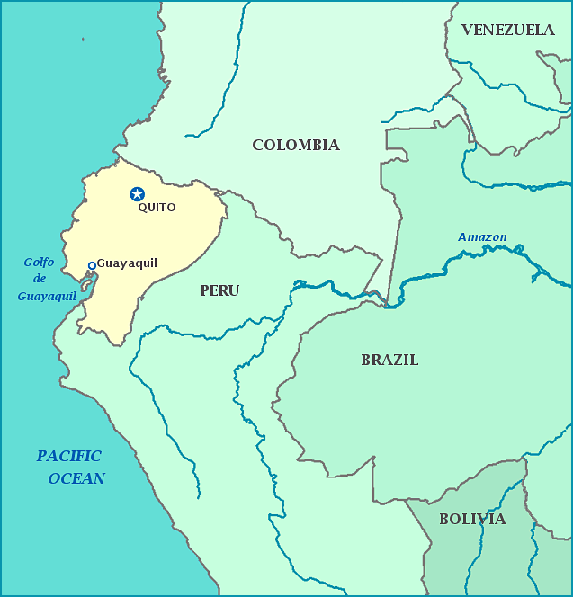
The Republic of Ecuador lies on the equator, facing the Pacific Ocean. It has been inhabited since the Paleolithic era. While Inca are the most famous pre-Columbian natives, there were many tribes inhabiting the region before who united in their own confederation. For years these tribes fought the invading Inca, but in the end most were absorbed into the Incan empire within two generations. The Spanish put an end to the reign of the Inca and the existence of autonomous tribes, such as the Cayapa. Many natives died from the Incan civil war in which their last king was captured, and harsh forced labor under the Spanish, though most died from diseases the invaders accidentally brought with them.
In 1809 independence from Spain was declared; though the freedom was short-lived, it inspired the rest of South America into revolutions of their own. Independence was finally achieved in 1830 for the country then called Gran Columbia, with rebels taking advantage of Napoleon's taking over Spain. This was only the beginning of problems for the new country. Politics were mired in instability, other countries split away only to take bits of more territory through war, And Peru refused to recognize the new country when the time came in 1832 for Ecuador to split away itself, resulting in war.
Sadly, Ecuador could not pay its soldiers, many of whom were hired from Venezuela and Columbia, making changing sides very appealing. While Ecuador was forced to surrender, tensions still remained, with skirmishes across the border of 13 different departments and territories, which are still claimed by both Venezuela and Ecuador today. When the Rio Protocol peace treaty failed, full-scale war broke out yet again between the Ecuador and Peru, earning Peru the nickname 'Cain de Latino America' after the Biblical Cain. The war ended in 1998 with the Brasilia Presidential Act, which ended the longest running territorial debate. Violence turned inward in the late 20th century, starting with the 1972 military coup, which held back democracy until 1979. The country saw further violence, thanks to severe restrictions on freedom of speech and press. In 2010 a protest turned into such a huge riot Peru closed its borders, fearing sentiments would spread, with fears on all sides remaining the same today.
Ecuador is home to 15% of all the world's bird species. Off the coast are the Galapagos islands, full of distinct wildlife native only to the islands and the site of many of Dr. Charles Darwin's studies of them. With the most biodiversity per square kilometer in the world, it is no wonder Ecuador was the first country to recognize the rights of nature.
