
Quill's Quiz - 1100 Question US Mega Geography Quiz
Print this map of Djibouti US States and Capitals Map Quiz
Free Maps, Map Puzzles and Educational Software: Owl and Mouse Educational Software
Print this map of Djibouti US States and Capitals Map Quiz
Free Maps, Map Puzzles and Educational Software: Owl and Mouse Educational Software
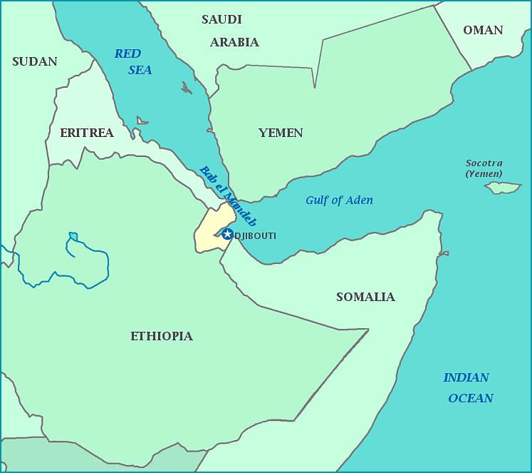
Djibouti, short for The Republic of Djibouti, was formerly known as Obock, French Somaliland, and the territories of Afars and Issas. In antiquity, Djibouti was probably part of the Land of Punt, famous in Egypt for exporting gold, ebony, ivory and other precious materials, as well as wild animals, presumably from many places in sub-Saharan Africa. Modern-day Djibouti is next to the "Horn of Africa", at the narrowest point where vessels on the Red Sea pass between Africa and the Arabian Peninsula—a very advantageous point for trading. While it gained independence from France in 1977, it retains friendly relations with the country as well as receiving economic support. The country is known for taking its name after its capital, and for the presence of the Djibouti National Park.
