
|
|
|
||
|
Map of COTE D'IVOIRE |
|||
|
Find more Free Maps at our Maps and Geography Page
|
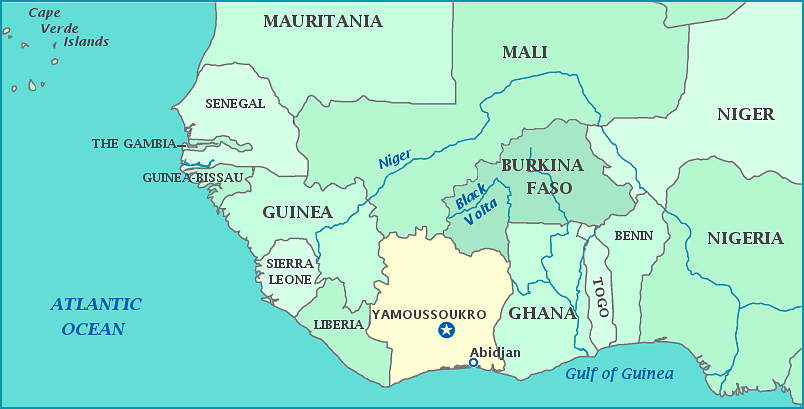 More Maps of Africa Print this map of Cote d'Ivoire Surrounded by Liberia, Guinea, Mali, Burkina Faso, Ghana, and the gulf of Guinea in the Atlantic, Cote D'Ivorie is a coastal country in West Africa and is one of the most prosperous countries in Africa. Felix Houphouet-Boigny slowly negotiated equal rights for native Africans, as he rose to political power. Eventually the French claimed less and less direct power over the country, until granting the country independence in 1960. As president, Felix Houphouet-Boigny aided agricultural growth and in 1979, the country became the leading producer of cocoa in the world, soon followed by palm oil and pineapples. While the capital is Yamoussokro, it lags far behind the major cities of Abidjan, Abobo, Bouake, Daloa, and San-Pedro in population. Despite this growth and prosperity, especially in contrast to many other African countries, Cote D'Ivoire has suffered several intense civil wars from 1999 to 2011. Population: 22,400, 835 [2013 est] Area: 322,463 km2
|
© Owl and Mouse 2007-2014